Chile does not reveal itself from the first point on the map. The country stretches so far along the continent that traveling through it feels less like moving across one nation and more like crossing several climates, histories, and ways of life. In the north, abandoned industrial towns sit in desert air so dry that entire streets still look almost suspended in time. In central Chile, the hills of Valparaíso rise above the Pacific while the staircases of Sewell climb into the Andes. Further south, roads turn wet and green, ferries replace highways, and wooden churches appear between fishing villages and narrow inlets. Then the route suddenly leaves South America altogether and disappears into the Pacific Ocean toward Rapa Nui, where Chile no longer feels Latin American but deeply Polynesian.
That is why a UNESCO journey through Chile cannot be planned as a simple checklist. The order matters. If you move randomly between sites, the country quickly turns into a chain of expensive flights and exhausting transfers. If you build the route properly, the UNESCO sites begin to connect naturally: from the world’s oldest artificial mummies and ancient Inca road systems to nitrate ghost towns, wooden island churches, and the moai standing alone in the Pacific.
The ideal version of this trip takes five to seven weeks. That is the pace where Chile still feels like a country rather than a sequence of airports. Faster itineraries are possible, but they force you to constantly choose between depth and logistics.
01Chile’s UNESCO World Heritage Sites
Chile currently has seven UNESCO World Heritage Sites:
- Rapa Nui National Park
- Historic Quarter of the Seaport City of Valparaíso
- Churches of Chiloé
- Humberstone and Santa Laura Saltpeter Works
- Sewell Mining Town
- Qhapaq Ñan, Andean Road System
- Settlement and Artificial Mummification of the Chinchorro Culture in the Arica and Parinacota Region
These places do not share a single atmosphere. This is not a collection of “the most beautiful places in Chile” in the usual sense. Some sites are harsh, dry, and nearly empty. Others are urban, noisy, and deeply alive. Some require patience, long distances, and an understanding of the landscape around them.
That is why the best route is not the shortest one. It is the one that makes geographical and historical sense.
02The Best Route Through Chile’s UNESCO Sites
The most logical sequence is:
Arica → Iquique → San Pedro de Atacama → Santiago → Sewell → Valparaíso → Chiloé → Rapa Nui
This route moves gradually from north to south before leaving the continent entirely for the Pacific. It also works well logistically because nearly all major domestic connections eventually pass through Santiago. Rapa Nui makes the strongest final stop. After the island, returning to mainland rhythms feels strangely abrupt.
03Arica and the Chinchorro Culture
Recommended time: 3–4 days
The best place to begin is Arica, in the far north of Chile near the Peruvian border. It is a dry Pacific city where the desert reaches almost all the way to the ocean. There is very little theatrical tourism here, which makes it a strong introduction to the country. Chile immediately presents itself through history and landscape rather than spectacle.
The main reason to come is the Chinchorro culture. These communities practiced artificial mummification thousands of years before Ancient Egypt. Unlike Egyptian burial traditions, Chinchorro mummification was not reserved only for rulers or elites. Infants, children, and ordinary members of society were also preserved.
The best starting point is Museo Arqueológico San Miguel de Azapa. Inside, it becomes clear how sophisticated the techniques actually were. Bodies were disassembled, reinforced, reconstructed, coated with clay, and painted black or red depending on the period. These are not simply “ancient mummies.” They represent one of the earliest known examples of a society developing complex rituals around death and memory in an extremely harsh environment.
After the museum, Arica itself deserves time. Walk toward Morro de Arica late in the day when the Pacific light softens the desert hills. Visit local seafood markets in the morning. Drive into the Azapa Valley where agriculture survives because of underground water systems crossing one of the driest regions on earth.
Northern Chile works best slowly. The atmosphere matters as much as the archaeology.
04Humberstone and Santa Laura
Recommended time: 2–3 days
From Arica, continue south toward Iquique. The road cuts through enormous stretches of desert where almost nothing interrupts the horizon. Against that landscape, the nitrate towns of Humberstone and Santa Laura feel even more unsettling.
Humberstone and Santa Laura Saltpeter Works were industrial settlements built during the nitrate boom of the late nineteenth and early twentieth centuries. At the time, nitrate was essential for fertilizers and explosives, turning northern Chile into one of the world’s most economically important mining regions.
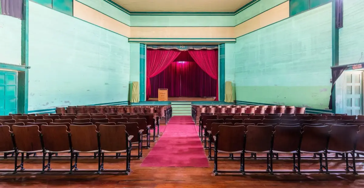
Entire towns emerged in the desert around processing plants: schools, theaters, hotels, markets, swimming pools, and worker housing. Then synthetic nitrate production changed global demand. The mines closed, the population disappeared, and the towns were abandoned.
Today Humberstone feels less like a restored heritage site and more like a city where life simply stopped moving. Wooden facades still stand beneath the desert sun. Rusting machinery stretches across empty ground. Old signs remain attached to walls. The theater still faces silent streets.
The dryness of the Atacama Desert preserves things unusually well, which makes the place feel physically close to its industrial past.
It is best to stay in Iquique and visit Humberstone as a day trip. Iquique itself is worth several nights. The city sits between giant sand dunes and the Pacific Ocean, and in the evenings paragliders drift above the cliffs while the waterfront fills with locals. After the silence of Humberstone, the contrast becomes part of the experience.
05Qhapaq Ñan and San Pedro de Atacama
Recommended time: 5–7 days
Qhapaq Ñan is the most difficult UNESCO site in Chile to experience in a conventional way. It is not one monument or archaeological zone but part of the enormous Inca road system that once crossed much of western South America.
In Chile, the surviving sections are connected to Andean trade routes, desert crossings, and high-altitude movement through the mountains. For travelers, this site is less about arriving at a single famous landmark and more about understanding the historical geography of the Andes.
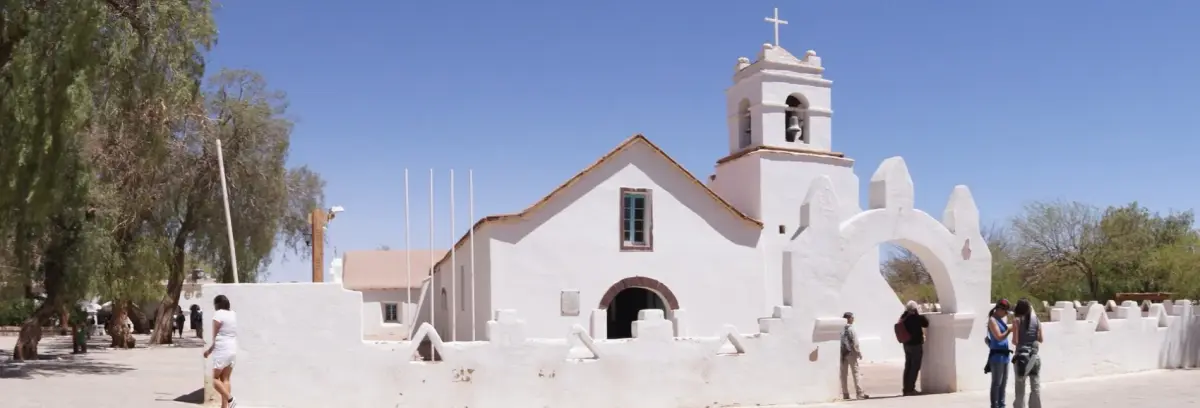
The easiest way to approach this part of the journey is through San Pedro de Atacama.
San Pedro itself is not a UNESCO site, but it explains why this region mattered long before modern tourism existed. Caravan routes once crossed these deserts, linking Andean communities through trade and movement across impossible terrain.
San Pedro deserves time. It should not be reduced to two rushed nights between flights.
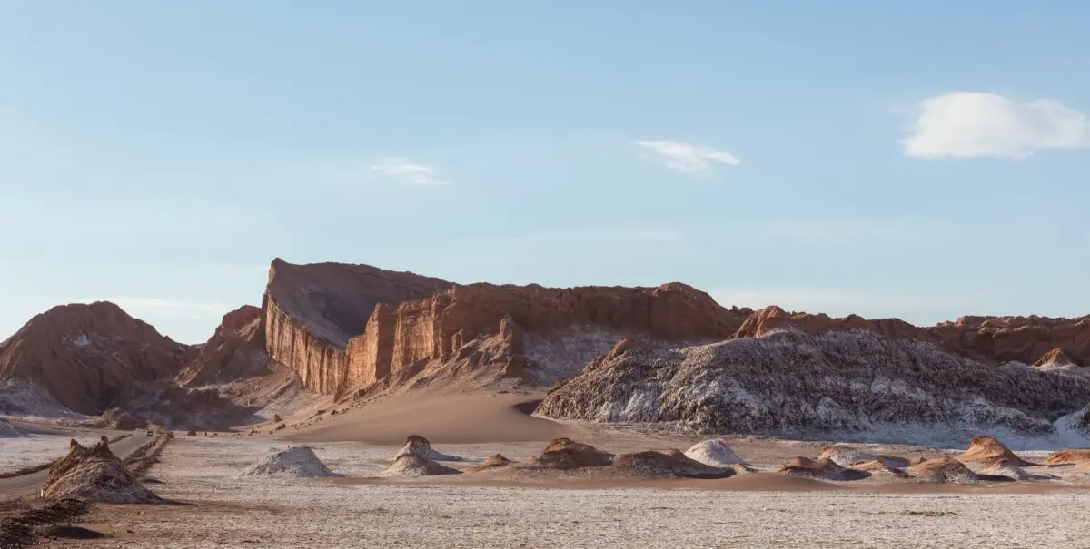
The landscapes constantly change: salt flats, volcanic horizons, geothermal fields, flamingo lagoons, and valleys shaped by wind and mineral erosion. Days are intensely dry and bright while nights become unexpectedly cold.
The best experiences here are usually the quietest ones:
- sunrise at El Tatio before the tour buses arrive;
- late afternoon in Valle de la Luna when the shadows reshape the desert;
- high-altitude roads where vicuñas graze near salt lagoons;
- stargazing beneath some of the clearest skies on earth.
Five to seven days creates enough space for the desert to stop feeling like a sequence of excursions.
06Santiago and Sewell
Recommended time: 4–5 days
After northern Chile, Santiago feels like a sharp change of scale. Suddenly there are dense neighborhoods, museums, long avenues, and snow-covered mountains appearing behind the city skyline.
Many travelers use Santiago only as a transport hub, but that misses an important part of modern Chile.
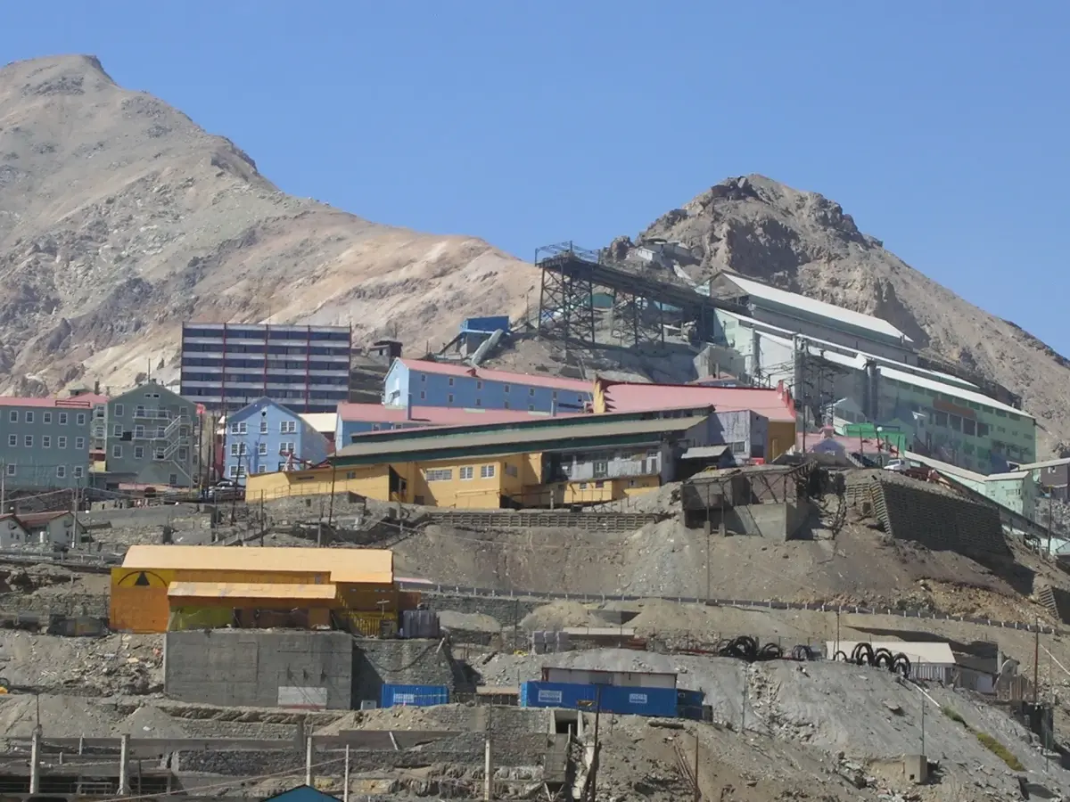
The main UNESCO site nearby is Sewell Mining Town, a former mining settlement built high in the Andes for workers from the El Teniente copper mine.
Because the town sits on steep mountain slopes, Sewell developed vertically. Staircases replaced streets. Colorful wooden buildings climbed upward around industrial infrastructure and worker housing.
Unlike Valparaíso, Sewell cannot be visited casually by public transport. Access is controlled because the surrounding mining operations are still active, so most visitors arrive through organized tours from Santiago or Rancagua.
Sewell is important not only because of its architecture but because it reveals another side of Chilean history: copper, labor, foreign investment, and mountain industry.
After Humberstone, Sewell becomes even more interesting. One tells the story of nitrate and desert extraction. The other tells the story of copper and the Andes.
A full day is enough for the site itself, but Santiago deserves several nights so the central section of the trip does not become pure transit.
07Valparaíso
Recommended time: 3–5 days
Valparaíso is impossible to understand properly from a car window. The city has to be walked: uphill, downhill, through staircases, old elevators, narrow streets, hillside neighborhoods, and port districts shaped by geography rather than urban planning.
UNESCO protects the historic urban fabric of the city itself rather than one monumental building. Valparaíso expanded across steep hills because there was little flat land near the port. Funicular elevators became essential infrastructure. Houses climbed unstable slopes. Streets adapted to terrain instead of imposing order onto it.
The most visited neighborhoods are Cerro Alegre and Cerro Concepción, but limiting yourself to those areas misses the real atmosphere of the city. Valparaíso becomes most interesting in the transitions between tourist streets and ordinary residential life, between viewpoints and working port zones, between brightly painted facades and weathered stairways.
It is easy to describe Valparaíso with clichés like “bohemian” or “colorful,” but those words flatten the city into something decorative. Valparaíso is rougher than that. Some streets feel worn down. Others are unexpectedly beautiful. The city remains active, layered, imperfect, and deeply tied to maritime history.
Three days is the minimum. Five days allows time to experience different rhythms of light and weather, especially early mornings when fog still hangs above the hills.
That is why a UNESCO journey through Chile cannot be planned as a simple checklist. The order matters. If you move randomly between sites, the country quickly turns into a chain of expensive flights and exhausting transfers. If you build the route properly, the UNESCO sites begin to connect naturally: from the world’s oldest artificial mummies and ancient Inca road systems to nitrate ghost towns, wooden island churches, and the moai standing alone in the Pacific.
08Chiloé and the Wooden Churches
Recommended time: 5–7 days
Southern Chile changes the emotional tone of the journey completely.
The dry landscapes disappear. Roads become green and wet. Ferries replace highways. Wooden houses stand above tidal water. Weather begins to shape schedules.
The UNESCO-listed Churches of Chiloé are among the most distinctive religious buildings in South America because they combine European missionary architecture with local woodworking and shipbuilding traditions.
Unlike the stone cathedrals found elsewhere in Latin America, the churches of Chiloé were built almost entirely from wood. Builders used local timber and techniques developed in a maritime environment shaped by rain, boats, and isolation.
The result feels less imperial and more deeply connected to island life.
There are sixteen UNESCO churches spread across the archipelago, but trying to visit every single one usually becomes exhausting. It is better to focus on several important locations such as Castro, Achao, Nercón, Tenaún, and Quinchao while leaving time for the archipelago itself.
Chiloé is not only about churches.
It is about ferry crossings, fishing villages, wooden houses on stilts, coastal roads, heavy clouds moving over the sea, and food shaped by isolation.
The defining local dish is curanto. Traditionally, shellfish, meat, potatoes, sausages, and potato cakes are cooked together in an earth pit lined with hot stones and covered with giant nalca leaves. The method reflects practical island cooking rather than restaurant performance.
Chiloé should not be compressed into two rushed days. Weather changes constantly, and many of the strongest moments happen between destinations rather than inside them.
09Rapa Nui
Recommended time: 6–8 days
Rapa Nui works best as the final chapter of the route. After the island, mainland Chile feels psychologically distant.
This is not simply “Easter Island with statues.” Rapa Nui is a Polynesian island in the middle of the Pacific Ocean, extremely far from continental Chile. The flight itself changes your perception of distance. A country that began in desert mining towns suddenly extends deep into the ocean.
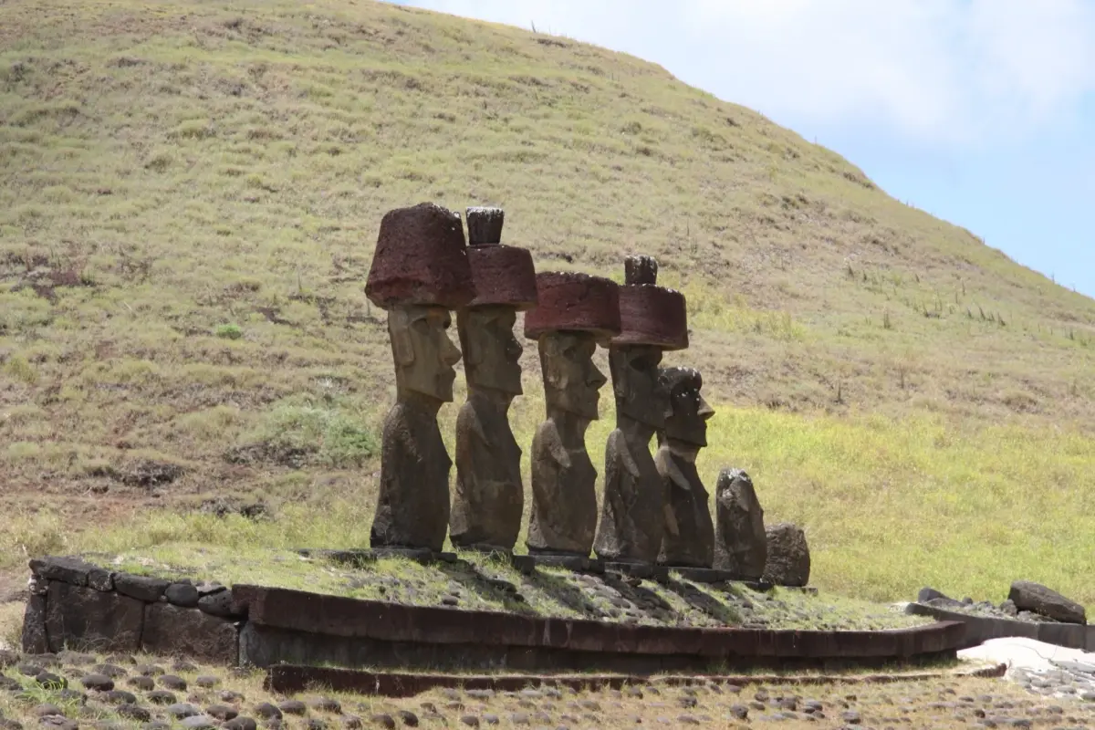
The main archaeological zones lie within Rapa Nui National Park. The moai are scattered across the island rather than concentrated in one place. Some stand on ceremonial platforms near the coast. Others remain unfinished inside the quarry at Rano Raraku where they were carved directly from volcanic stone.
The essential sites include:
- Ahu Tongariki;
- Rano Raraku;
- Orongo;
- Anakena;
- Rano Kau.
But Rapa Nui becomes far more meaningful once you stop treating it as an archaeological park and begin understanding it as a living island with its own language, culture, memory, and relationship with mainland Chile.
Six to eight days creates enough room for weather changes, slower exploration, and returning to archaeological sites at different times of day. Rapa Nui rewards patience. Sunrise at Ahu Tongariki, the road toward Rano Raraku, horses moving through tall grass above the Pacific — these experiences only work properly when the itinerary still has space left inside it.
10How Much Time Do You Need?
Minimum reasonable pace: 4 weeks
Possible, but fast. Chiloé becomes shorter, northern Chile more compressed, and flights much more frequent.
Ideal pace: 5–7 weeks
The best balance between logistics and immersion.
Slow and deeper version: 8 weeks or more
Enough time to stay longer in Atacama, Valparaíso, Chiloé, Santiago, and Rapa Nui.
11Example of an Ideal 6-Week Route
- Days 1–4: Arica
- Chinchorro culture, San Miguel de Azapa Museum, Morro de Arica, Azapa Valley.
- Days 5–7: Iquique and Humberstone
- Iquique, Humberstone, Santa Laura, dunes and Pacific coast.
- Days 8–14: San Pedro de Atacama
- Atacama Desert, high-altitude lagoons, El Tatio, Valle de la Luna, Qhapaq Ñan context.
- Days 15–19: Santiago and Sewell
- Santiago neighborhoods and museums, full-day trip to Sewell.
- Days 20–24: Valparaíso
- Cerro Alegre, Cerro Concepción, historic elevators, port districts, hillside walks.
Days 25–32: Chiloé Castro, Achao, Nercón, Tenaún, Quinchao, wooden churches, ferries, seafood markets, curanto.
- Days 33–40: Rapa Nui
- Ahu Tongariki, Rano Raraku, Orongo, Anakena, Rano Kau, slower island days.
This version leaves buffer time for weather, flights, and rest. In Chile, that is not wasted time. It is part of realistic planning.
12The Real Logic of This Journey
This route works best when it stops feeling like a UNESCO checklist.
Chile reveals itself through transitions:
- desert to ocean;
- ocean to mountains;
- industrial north to maritime south;
- mainland South America to Polynesia.
Arica introduces deep ancient history. Humberstone explains industrial extraction and abandoned wealth. Qhapaq Ñan reveals how the Andes were connected long before modern borders existed. Sewell tells the story of copper and labor. Valparaíso shows maritime Chile. Chiloé reveals island culture shaped by rain, wood, and the sea. Rapa Nui pushes the country beyond the continent itself.
Done properly, this becomes much more than a route through UNESCO sites. It becomes one of the clearest ways to understand Chile through landscape, distance, labor, architecture, and isolation.